Eastern Montana

Heading down out of Glacier National Park, you enter the rolling prairies of Eastern Montana. Cut Bank, a town so-named for the local river that, well, cuts through the rather prominent bank, has little to otherwise recommend it. There is one “diner and lounge” that lets you wash down your roadside burger with a surprisingly decent selection of beer, but that is about it. It’s also (I hope), the community farthest to the east of Glacier National Park that claims to be a “gateway to Glacier”. By the time you’ve reached Cut Bank, you’ve passed numerous communities claiming to be gateways to Glacier, all with more claim than Cut Bank, from which the most you can say is that the mountains are visible on the hazy horizon.

Shelby, just a short jaunt down the road, in, they claim, the beginning of Sweet Grass Hills country, is probably a better place to overnight. There is at least a store with a hodgepodge collection of local objects, appropriately named the Prairie Peddler, which serves a drinkable latte. The diner next door, however, should be avoided; just make your own breakfast.

Continuing east on HW-2, you’ll notice the road is dotted with historical markers describing the area. After driving too quickly past a sign that read “The oily bird gets the worm”, I decided it may be entertaining to stop at the next sign. It turned out to be a cheery stop.The Baker Massacre

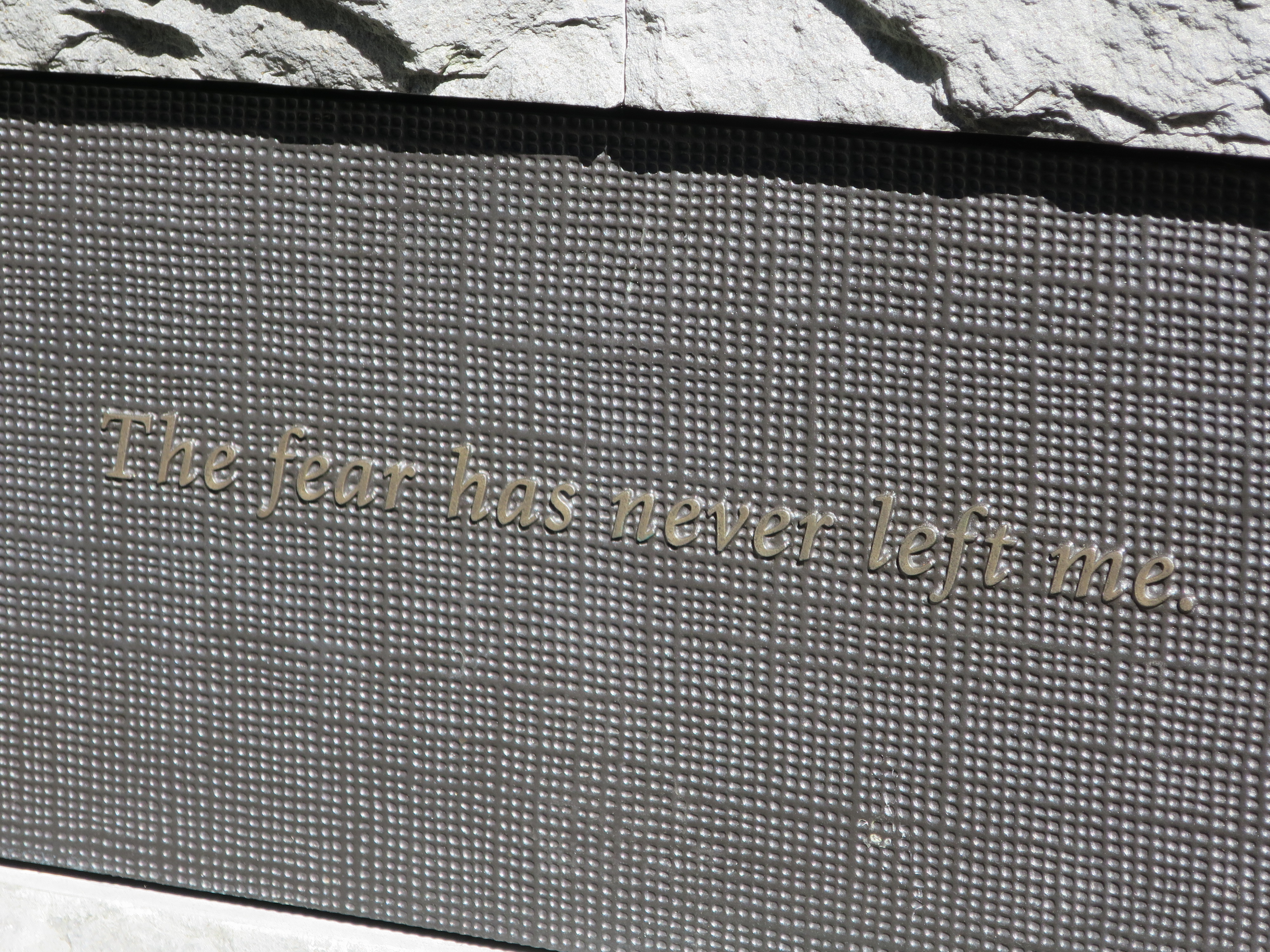
The Baker Massacre. On January 23, 1870, soldiers commanded by the Colonel Eugene Baker killed 173 Blackfeet Indians in a surprise attack on Heavy Runner’s camp near here on the Marias River. The strike was in retaliation for the killing of Malcolm Clarke at his ranch near Helena in 1869. A man of peace, Heavy Runner had no quarrel with the US Army. His people did not participate in Clarke’s killing nor were they hiding the perpetrators of the crime. Waving his good conduct papers and metals, Heavy Runner was the first casualty of the Baker Massacre that cold January morning. With most of the men away hunting in the Sweet Grass Hills, the soldiers fired into the lodges where women, children, and elderly slept. The soldiers took more than 100 prisoners, but once they realized many were infected by small pox, released them with no food, clothing, or shelter in subzero weather. Many refugees froze or starved to death seeking shelter in nearby camps or at Fort Benton. Ironically, the soldiers were in pursuit of a hostile band led by Mountain Chief, who was camped several miles downstream of the attack. The Baker Massacre profoundly impacted the Blackfeet people and is very much alive in tribal memory.

Chester is a pleasant place to stop for a bit. At this point in Montana, you almost don’t notice signs like these.Peace on Earth

But certainly you notice a sign like this.Flying Farmer

Unfortunately the local diner appeared to be a thing of the past. Or perhaps it just has extremely limited hours. It’s hard to tell; you can never trust signage on stores in small towns. When a place first opens, they put up a sign with their hours, and after that any changes are typically distributed by word-of-mouth.Old diner

If you stay in Havre, don’t stay at the fairgrounds. Right off HW-2, the facilities are terrible and the spaces are far too expensive. Across the street, however, is an extraordinarily ugly shopping mall that hides an excellent Buffalo Jump. The view from the Buffalo Jump is better facing north.Holiday Village, Havre, MT

The buffalo probably had a nice view before they were driven off a cliff and then, if they survived the fall, stabbed to death by atlatl-thrown spear.Buffalo death view

The Buffalo Jump itself is an interesting site, as you can walk through and see the archeological finds in situ, protected from the weather by huts built around them. For some reason they didn’t actually let me walk, instead preferring to “cut a half-hour” from the tour by taking an old jeep, even though a heavy thunderstorm the night before meant that this mode of transport left both driver and passenger soaked from jeep-collected rainfall. People in Montana generally seem to feel that anything over a 1/2 mile is “too far to walk”, and in this case, anything which includes an incline is better done seated.

Whoever determined this should be a tour site also decided it was necessary to completely fence the area off, and regrettably they left out the hilltop area that was used as a campground during the hunt. By the time they realized this, they were out of money and could not extend the fence. Given that the campground is on BLM land, you might think that they would just put a gate in said fence, but then perhaps that would require admitting that the fence was not really necessary in the first place. In any case, if I’d had time I would have checked if there was access to that particular slice of BLM land. (BLM land is like that — if you can access it, you’re welcome to hike and camp on it, but sometimes there is no public access route.)

Buffalo jump area

As you drive into Havre from the west, be sure to note the “Loans and Guns” business on the righthand side. They’ve got you covered if you need a loan, a gun, or perhaps a loan to buy a gun.

Havre proper has a great bakery in the basement of the Atrium, a rather ugly shopping complex that improves once you are inside; they serve decent drip coffee and fresh cinnamon rolls in the mornings. Across the street, you can see the old WPA-era post office, which was sold off in 1995, and finally restored for use as office and event space after sitting vacant for several years. Outside, a nice fellow noticed me and offered me a coffee. This is the sort of place where people buy an extra coffee just because they might meet someone who will want it.Havre post office

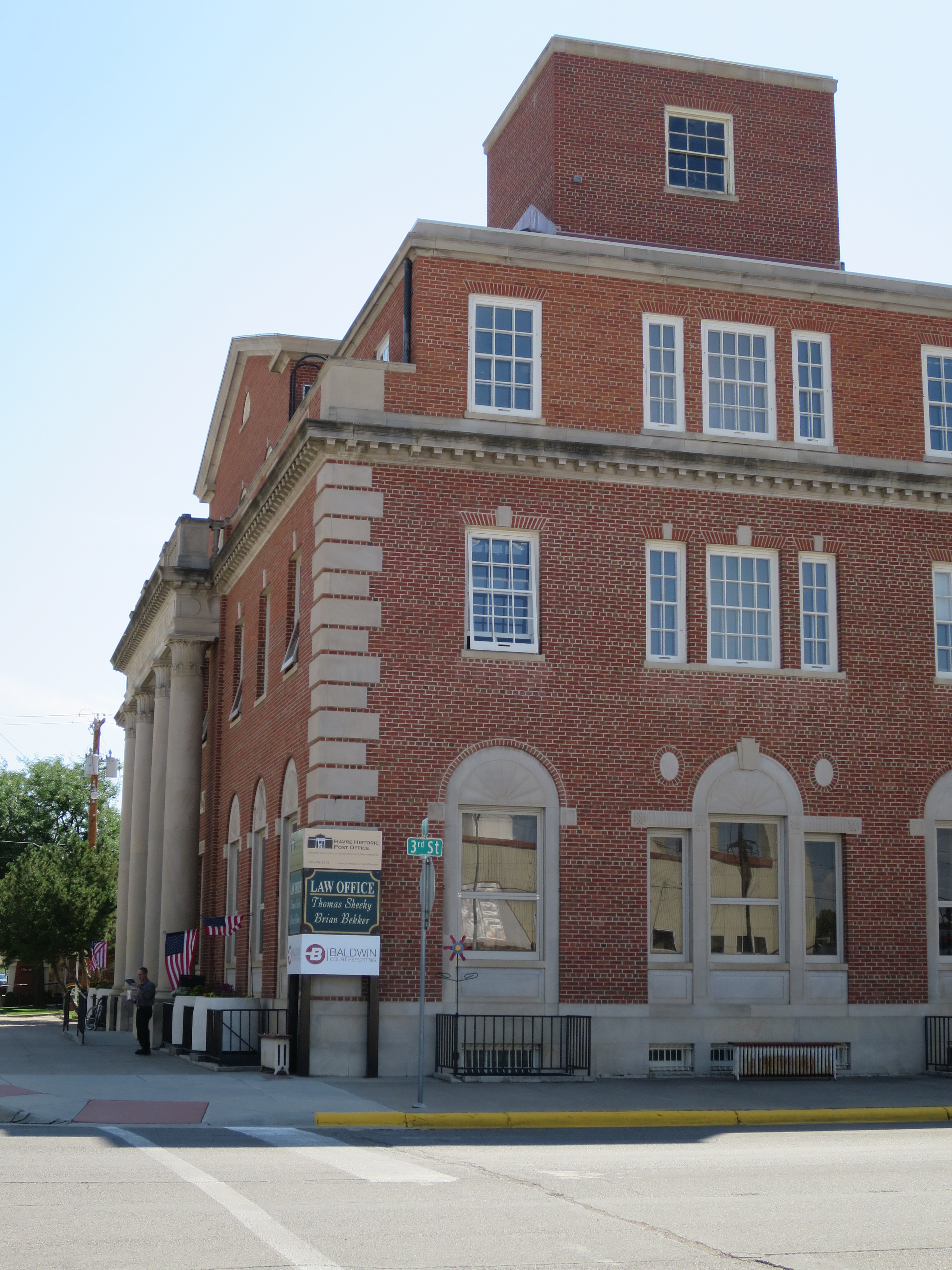
Downtown there is also the Palace Bar. The owner will tell you that the back bar came up the river in the early 1900s. They did have a train then, though, so I’m skeptical. The owner is friendly, and his pool buddies offered me a free drink once they heard my story, and offered a great camping suggestion I probably would have missed otherwise.

Palace Bar

Following the pool players’ suggestion, I detoured around Glasgow down to Fort Peck. My site was quite private, with a lovely view. I also got to learn exactly how tight a u-turn the trailer can make.A private camping spot

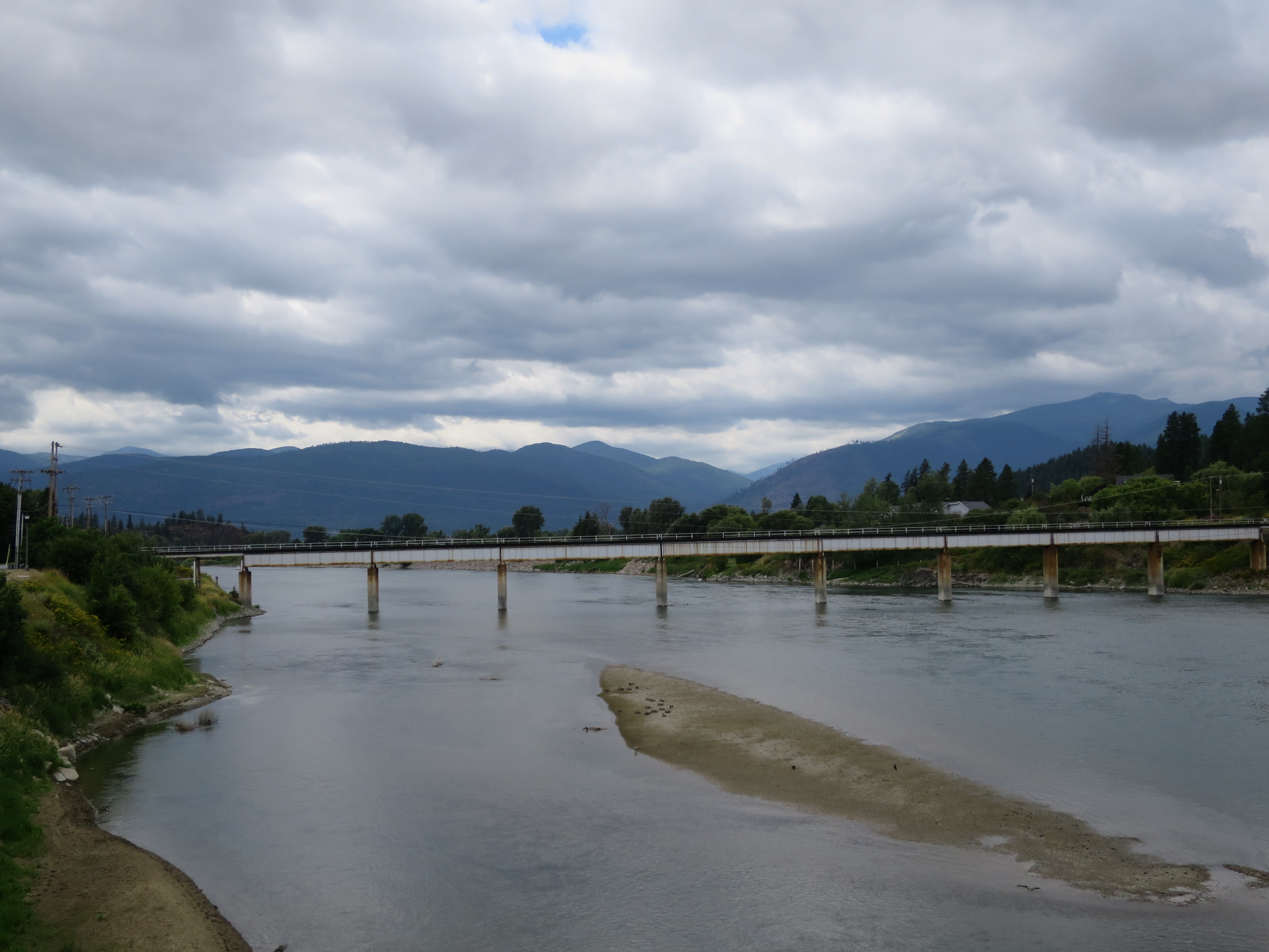
Fort Peck itself is a man-made lake. In the days of Lewis and Clark (you get to hear about everything from the supposed viewpoint of Lewis and Clark in pretty much all of the northern mid-West; things weren’t “discovered” until they were seen by Lewis and Clark, etc., etc.), this site had the Big Dry River running (or, more usually, not running) through it. Near here, Captain William Clark supposedly spotted and then named the river that winds along much of HW-2 in eastern Montana, the Milk River. It has a nominally milky appearance, I think because of clay, and flows into the Missouri near Fort Peck. If you check Wikipedia, you’ll note the credit is given to Lewis, since he is of course the one who bothered to write down the observations of Captain Clark.the Big Dry

Fort Peck has some nice historical markers and outlooks. I’m glad I missed a turn and was able to experience the view and this sign.Sacagawea

And yet more of the view.More of the view from Fort Peck

Having run out of food, however, I couldn’t stay at Fort Peck very long. In the final parts of Montana, you get to pass by numerous motels whose best advertisement is apparently “clean rooms”. And a sign that says “Kremlin, USA style” with a painted American flag.


Glacier National Park

On the advice of the ranger I met at the actual Columbia Falls farmers market—The Columbia Falls Community Market, so named, I presume, because this is the farmers market the community actually attends—I drove to Polebridge through Glacier National Park. Although a longer route, it was, he said, a much nicer road, and worth it to save the wear and tear on the vehicle. He further encouraged me to continue on from Polebridge up to Bowman and Kintla lakes, and said I could even take my trailer. Thankfully, I ignored this piece of advice; more on that later.

Polebridge, I had read, was a community without electricity on the northwestern outskirts of Glacier National Park, famous for Polebridge Mercantile, which has served as a general store, post office, and bakery for the few local residents for over a hundred years. Though it was unclear if the post office part is still true, the bakery is alive and well. They have huckleberry everything.Polebridge Mercantile

If you want a remote bar, then the Northern Lights saloon next door should suffice, which inhabits the rather homey cabin built by the original proprietors of Polebridge Mercantile.Northern Lights Saloon

Those two buildings are, I think, all of Polebridge, though there seem to be some summer cabins next to the Mercantile, and I believe there are even a few full-timer dwellings in the area. I was disappointed to discover that new owners bought the Mercantile and saloon this year, and apparently decided to bring electricity with them. Still, the town is quiet and the scenery is beautiful.Polebridge

After eating my tasty pastry and drinking a few sips of the most burnt latte I’ve ever had, it was time to head down the road to the glacial lakes.Road to the Glacial Lakes

I somewhat wish I stopped after this picture, taken from the yellow sign you can see above.Another pretty glacial view

Kintla Lake is the more distant of the two lakes, and I decided I should go there first and hit Bowman Lake on the way back. The scenery is beautiful, but the road is rough, narrow, and full of potholes. I got to know the width of my vehicle quite well, because much of the time the road was barely wide enough for two vehicles. The rest of the time, it was somewhere between 1-1.5 car-widths wide with infrequent places to park half of your car off the road. It wasn’t that bad, I decided, after spending some time staring at the lake and wishing I’d stolen that canoe in Polebridge.Kintla Lake

Kintla Lake used to be the benchmark lake for the state, containing the cleanest water, according to an old ranger every passing child called “Grandpa”. This is what I learned while trying to discover if it was worth the extra 12 miles to see Bowman Lake, which is apparently the most photographed lake in Montana.

As it happens, the answer is no, but no one would tell me that. The road to Bowman Lake is much steeper and narrower. I passed a van full of kids that got stuck on the shoulder of the road and needed a tow; I was happy I didn’t have the equipment with me. I then got into a hand-wavy argument with an oncoming vehicle, whose driver didn’t seem to know that the vehicle heading downhill has the responsibility to reverse, not the vehicle heading uphill on the side of a cliff.

Bowman Lake was not markedly different from Kintla Lake, but I did end up in an unescapable conversation with an old-timer. He kept talking until the sun was about to set, interjecting at intervals that I should “go slowly” and “not drive in the dark”. He explained at length how he had started out with a tent and truck years ago, on a mission to find where he wanted to live after he retired. He quickly discovered possessions were a hassle and gave away his tent; tables, he said, or the back of his hatchback if it rained, worked much better.

He found out after a year or so that he didn’t want to live anywhere but on the road and he’d been travelling ever since. The only exception was about two months following an accident in which he’d totalled his vehicle; he’d stopped to visit his daughter, and was about to head back on the road when she insisted he was unwell and needed to see a doctor. Turns out he had bleeding in his brain, and the surgery held him up for another three months.

He was relatively upbeat until he got onto the topic of destinations. He morosely stated he was running out of places to go. When I suggested Canada, he said he’d never go to Canada, because “they have mosquitos there.” I didn’t ask about Mexico.


Columbia Falls; or, The case of two farmers’ markets

Columbia Falls started out as a huge disappointment. The RV park was so tight that my sewer outlet was placed directly behind my neighbors’ picnic table, which hardly seems sanitary, and this turned out to be true of my neighbors on the other side as well. I, being polite, did not set up my sewer hose until I was actually going to use it, and put it away immediately after. My neighbors bordering my picnic table, however, were not so considerate, and did not even have an airtight seal.

My politeness did get me free wine, however, so at least there’s that.

The owner was at least friendly, though when I remarked upon the placement of the sewer hookups, said “Well, it can’t be helped dear”, a rather unconvincing statement.

She did, however, point me in the direction of two farmers’ markets. Arriving at the nearest one, I was greeted with 5-6 stalls of crafts, sold by people who didn’t really look like they had made anything that they sold. There was no produce in sight, and, indeed, it turns out that there are no farmers involved in the “Columbia Falls Farmers Market”. A crotchety old man selling candy (which, granted, he may have actually made), grumpily answered my question as to the location of the other farmers market.

“I sure do hate to send people down there, it’s not a good place,” he said.

“Oh, why is that?”

“We set up shop there once, but I sure do hate to send people there. We couldn’t stay, people were wandering around with alcohol, drunk; it’s just not a good family environment. It’s held in the parking lot of a liquor store, see.”

“Right, it’s just that I’m trying to find dinner, not candy or scarves. Farmers markets, well, they generally have produce. Does the other farmers market have produce, at least?”

“Well now, I can’t speak to what they have. We used to have produce, see, but every time we get someone in they steal the vendor away.”

“OK, so they probably have produce. Where is it located?”

“Well now, I really hate to send people that way, we got into a huge fight with them, but it’s down the street at the liquor store.”

“OK, so I just continue straight?”

“Well, yeah, you can’t hardly miss it. But there’s alcohol, and drunk people.”

“OK, thanks. I’m going to go to the other farmers market now….”

Thankfully, the other farmers market actually did have farmers, as well as delicious food carts and live music. It also had drunk people, including a group of retired and ex-rangers who gave me advice on where to go in Glacier National park. Evening saved.

Entering Montana

On leaving Idaho you are greeted by a sign riddled with bullet holes. The sign sits next to a rundown casino on the Idaho side, so I suspect the patrons were expressing their feelings towards Montana. On the other hand, maybe the sign serves a dual purpose, and the denizens of Montana, on re-entering their state, express their joy at having left Idaho by shooting the sign.

Following the Kootenai River on Highway 2, a nice place to rest for a bit is Kootenai Falls.

There is even a swinging bridge, which has a nice view.View from the swinging bridge

From the center, I decided two things. One, swinging bridges are not my favorite place to stand; and two, it’s probably smart to know the age of a sign that says “Limit of 5 people on bridge at a time”. A dog on the bridge with me agreed on at least the first point.Swinging bridge.

And yes, there is also a nice little waterfall area.Kootenai Falls

The Museum in Bonners Ferry, ID

The museum in Bonners Ferry is worth the $2 it takes to visit. It’s not so much a museum as a hodgepodge collection of local antiques and not-so-antique objects, much what you might expect to find at a combination antique/pawn shop, if such a thing were to exist. It’s filled with creepy dolls dressed up as various former village characters, but there is no coherent town story told. Dr. Day, together with the silver dollar he kept in his pocket from the day he arrived in Bonners Ferry until the day he died, for example, stands at attention in a makeshift office with rusty medical equipment.

My favorite room has an old one-handed pump car as you enter. When you turn around, you are greeted with an entire wall filled with portraits of historical figures tied to the area in some haphazard way. The wall of old white men

They are mostly old white men, but I counted one portrait of an old white couple, one white woman, two chieftains of the Kootenai tribe (perhaps to commemorate their defeat or other unfortunate abuse at the hands of the old white men?), and one Kootenai woman, whose claims to portraiture appear to be that she married a white man and was the daughter of a chieftain, probably in that order. I was unsurprised by all the old white faces until I realized that the painting technique looked suspiciously the same, and, indeed, these are all modern renditions painted by the same enterprising artist, a woman named Bette Myers. Apparently enclaves still exist in which the historical role played by women is steadfastly ignored, even by women.

I assumed that Bette (who is now deceased) was a religious woman, because sandwiched in between all those old white men is, you guessed it, a white Jesus.Jesus and the Kootenai woman who married a white man

If you Google her, you’ll find that the domain truefaceofjesus.com is devoted to her work, and you can read all about her encounter with White Jesus, whom she apparently painted a decade after her life-after-death experience.

Considering I saw this sign in a previous room, I really shouldn’t have been surprised.Offensive sign

Continuing in this amazing portrait hall, you are greeted with an impressive display of woodworking. One denizen of the town, apparently as religious as Bette, mastered the scroll saw after he retired, and crafted beautiful clocks that he gifted to the museum upon his death.IMG_1594 Clocks

On the last wall of the room are handcrafted wooden toys, also gifted to the museum after the maker passed. I thought for a minute the woodworker must have had no living family, to have left such amazing toys to a museum, where they will never again be enjoyed by a child (or an adult like me) but in fact they had been gifted by his family, not him. I suppose because he made toys to commemorate the past industries of Bonners Ferry, but I can’t help thinking that’s no excuse.Wooden toys

On the way out, I noted that Bonners Ferry also has a talented knapper; the display didn’t say if said knapper was living or dead.Knapper


Bonners Ferry, ID

The village center has some nice public spaces,Public space

and a good bookstore, which is next to a placed called ‘Woody’s Gun & Pawn LLC”.Books and guns

At the old brick post office, which for some reason the US Government hasn’t attempted to sell yet, I found myself engaged in an apocalyptic discussion with two women, one of whom was very worried about dying in a flood, should a catastrophic failure of the nearby dam occur. “A lot of people would die, that’s for sure. I guess you just say, ‘Well, at least it’s been a good run.'”, she shrugged.

She went on to express frustration that no government employee would tell her just how high up on the mountain she should build her homestead in order to survive such a flood, no matter how many times she inquired. “It’s a mathematical calculation, see.”

After discussing the depths of various building foundations in town, the two women decided the Post Office and the Court House were the only two buildings likely to remain standing.To Survive a FloodTo survive a flood

About a block away from the post office and court house in any given direction and you are on the outskirts of town.General Feed and Grain

And the view from around the corner.Another angle

And heading back “downtown” towards the museum—a post for another day—you can see the clock tower of City Hall.Behind City Hall

The Kootenai River runs through the village. Before someone named Bonner arrived and convinced the locals it would be OK for him to take over ferrying white people across the river, and before the US Canadian border haphazardly divided their land, this was Kootenai territory.

The Kootenais are very proud of the fact that they are one of the few tribes that steadfastly refused to sign a treaty with the US Government and never agreed to leave their land for reservations. In 1974, all 67 of them declared war on the US; in response to this peaceful conflict and the ensuing publicity, the US government deeded them 12.5 whole acres of their ancestral homeland. That is some kind of victory, I suppose.

The view from a bridge that replaced the bridge that replaced the ferry. (Too ugly to actually show; the original ferry replacement was quite beautiful, apparently.)No more ferry, Bonner

And the town’s original source of electricity, a Pelton wheel.Pelton wheel


Wenatchee, WA

They water the air here. Air Irrigation

And go out of their way to ensure no one drowns in the Columbia River.Don't drown.

Otherwise, Wenatchee is similar to Davis: small, hot, nice bike paths (except of course here they irrigate the grass alongside said paths), and snobby bike stores. Granted, this one was worse than any I’d been to in Davis; at least there they assumed you wanted to fix your malfunctioning bike. Here, they told me nothing was wrong except the bike chain had gotten stretched out, and told me I was wrong when I explained that when shifting the day before, the chain kept dragging on the front derailleur, since “it wasn’t that far off”. They acted surprised when I asked them to replace the chain, since, after all, “it should still work as is”.

Wenatchee is less flat than Davis though, so nicer views.Columbia River

But beware getting caught on the wrong side of the train tracks. You may have to go out of your way, onto busy streets, on a broken bike that someone will later tell you is not broken.train

Portland’s Holocaust Memorial

A beautiful, peaceful space, set in a forested park. I happened upon it.Holocaust memorial wall


The wall has quotes from Holocaust survivors who moved to Portland.Life was uncertain


All of us children were crying for our parents. A guard came over to us and yelled, “Stop all of your whining! See that chimney, see that smoke, smell that stench in the air? That is your parents!”


Left by the wayside


One night the Arrow Cross lined us all up at the edge of the Danube River. The line stretched in both directions as far as I could see. The cold stillness of the night air was broken by the sound of gunfire as the Nazis walked down the line shooting every standing person one by one. They stopped shooting just as they got to me.


IMG_1433

And around Portland

At a wine bar across the street from a Sri Lankan children’s talent show. Because while the kids were adorable, the show was over four hours long.More wine


Vista House, a travellers’ way station east of Portland.Vista House

And the vista.The vista

“Simply a great rest-house”.Traveller's haven